Colombia, Tatacoya, Caño Cristales, San Agustin and Las Lajas

October 8 – 31, 2017

As we were leaving the Archeological Park of Tierradentro we received a message from our Overlanding buddies, Doug and Fran, wanting to know if we were interested in meeting them at the Tatacoa Desert.  Sounds like a great idea … what’s a 90 mile run when it involves happy hour with friends!

In this blog we will share with you the couple nights we spend in Colombia’s second largest desert, a crazy drive to see a pink river, pre-Columbian statues, driving the presumably most dangerous road in Colombia, a volcanic crater lake, a church that looks like a European castle and our teary goodbyes to this amazing country after almost 6 months of life changing experiences.

Tatacoya Desert

Eventhough this is the second largest desert in Colombia, after La Guajira in the north of the country, the Tatacoa Desert is only 300 square kilometers but it’s packed with interesting sites and landscapes.

IMG_6123
So nice to be reunited with our Canadian friends Doug and Fran from Calder Escapes. The last time we saw them was in Santa Elena when we celebrated Medellin’s Flower Festival in early August (2017).
IMG_1347
Laberintos de Cusco, a maze of red rock formation, is the main attraction.
DSCN3333
In addition to its geography, Tatacoa’s atmospheric conditions combine with very little pollution make it ideal for astronomy. Unfortunately the night we wanted to visit the observatory the clouds came out!
IMG_1336
Rainbow in the desert.
DSCN3318
Sunset before the clouds set in.
DSCN3326
We got up at 6am to beat the heat and hit the trails!

We drove only 12 miles down the road and found this oasis in the middle of the desert, Valle de las Constelaciones. The underground water source kept the pool nice and cool all day while the sun was blazing and the thermometer reached 105 degrees. We had the place to ourselves until a small group of nice Colombians showed up for a little while, they even brought us a couple rounds of cold beers for happy hour! Life is good!

IMG_1356
IMG_1355
IMG_1364
IMG_1367
Horse culture is huge in Colombia no matter where you are.
IMG_1371
One of the many checkpoints. Wether it’s the police or the military, they ’ve always been friendly and professional and most of the time, start the conversation with a handshake. They just want to know where we came from and where we’re going and see the vehicle’s documents. These young militaries looked barely 18.
IMG_1376
A pit stop on the side of the road for a freshly pressed raw sugarcane and lime juice called Guarapo. The large sugarcane stock goes through the press and the extracted juice comes out on the other side and is immediately served with ice and lime juice, so so delicious and refreshing!

Doug and Fran asked us if we were interested in driving with them to go see the very remote Caño Cristales, which I had heard of but I though it was only accessible by plane because of the remoteness but also because the area surrounding La Macarena was a FARC (Revolutionary Army Forces of Colombia) stronghold. They were in contact with another couple of overlanders who was on the way there. Apparently, since the peace accord was signed in 2016, it is now possible to drive to the little town of La Macarena where the Liquid Rainbow is located. The other concern was the condition of the road since there was no data available, we didn’t know what to expect. Always up for a adventure, we decided to go! It was a 500 miles (800km) detour but hey, that’s all part of the journey!

We had to stuck up on groceries so we stopped and spent the night just outside the town of Florencia on highway 65 at Casa de Eventos Dary (aka Villa Isabel)

IMG_1387
Luz, the owner of Villa Isabel where we enjoyed a late afternoon in the pool and a quiet night. Can you tell who is Colombian here?
IMG_1389
Following Doug and Fran in Tigger the Tiger! On the road between Florencia and San Vicente del Caguan.
DSCN3336
We arrived in the small town of San Vicente del Caguan where we settled at Hotel Amazonas Real then had dinner with Rochelle and Yianni from Overland Diaries. They were coming back from La Macarena so they gave us the rundown on the road conditions and safety.

After registering our names and passports at the military check point the next morning, we hit the muddy dirt road, towards La Macarena to go see the pink river called Caño Cristales. It ended up being an 8 hour drive to cover 90 miles, crossing 2 dozen shabby  narrow wooden bridges, getting drenched in heavy rain, winching Tigger back up hill out of a ditch after he tried passing a caterpillar train and slipped, winching a motorized caterpillar up the same slick muddy hill and nearly tipping over Silver in a hidden mud rut requiring being winched out by Tigger. All that to see one of Colombia’s most beautiful natural wonder! A true adventure!

IMG_1843
Joe and Doug rebuilding one of the many bridges so we could cross it!
IMG_1399
Holy shit! what is going on here?? Tigger is in the ditch, there’s a caterpillar and Doug is taking a pee!!!
IMG_1401
As we got the winch out it started to pour!
IMG_1402
I had the best seat in the house!
IMG_1403
Now it’s the caterpillar’s turn!
IMG_1845 2
He gave us a big smile when he reached the top of the hill!

Then after a few more hours of driving it was our turn!

IMG_1408
Joe grabbing his head! It felt a lot worse then it looks …
IMG_1411
Good thing we had two ways radio because Doug and Fran were a few miles ahead, after hearing our call, they turned around and came to our rescue! The rear right tire is not even touching the ground!
IMG_1412
Not the most comfortable position to be in!

Caño Cristales (La Macarena)

We arrived in La Macarena around 4pm and went looking for information regarding the visit of Caño Cristales aka the River of 5 colors.

The liquid rainbow as it is also called is located within the Serrania de la Macarena National Park, for decades this region was off limit because of the war between the government and the guerrilla army known as FARC. With the civil conflict winding down, the park has been reopen to visitors in 2009 but was only accessible by plane and is quite expensive, a 3 day tour costing around $700.  Since 2017 the more adventurous overlanders can now reach the park by road and pay approximately $75/person for the guided tour .

In order to see the colors, which comes from the bloom of the Macarena Clavigera plant, not an algae, conditions have to be optimal which only happens between June and October when there is enough sunshine and the water level is just perfect.

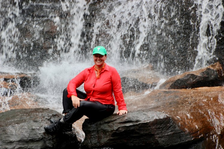
We were there at the right time of the year and the plant was in bloom but the sky was a bit overcast so we didn’t see the vivid 5 color effect but it was still spectacular and an unforgettable experience.

IMG_6166
Cormacarena is a regional government agency focused on sustainable development. It’s the agency that oversees all the tours in the park, they told us to come back the next day at 7am to be assigned to a group and watch a mandatory video about what to expect and what not to do. A maximum of 200 people per day are allowed in the Park, groups of 10-12 people are assigned different trails to make sure you don’t end up in one spot with to many people. We’re not big on tours and this one felt a bit rushed but it’s the only official option if you want to see it, even though we heard that you can find locals willing to take you by the “back door” for a fraction of the price.
IMG_6165
We had the visit of a sloth at our camp site
IMG_1422
The journey starts on the Guayabero river in these boats
IMG_1432
After the boat ride they check your bags to make sure you don’t have any bug spray or sunscreen to protect the fragile ecosystem of the river, that’s why everybody wears long sleeves and long pants even though it felt like a sauna! Then we got in 4×4 pick up trucks for a short ride.
IMG_1487
Then every group take different trails, ours was a total of 12km.

An this is it! How beautiful is that?

DSCN3380
Military presence is a common occurrence in this area
IMG_1459
It was SO SO HOT that when we came to the area of the river where we were allowed to swim we went in fully clothes even keeping our hiking boots!
IMG_1480
So refreshing after almost passing out from heat exhaustion!
DSCN3360
Another section of the hike through the rain forest
IMG_8289
This sections was the most colorful! Isn’t spectacular?
DSCN3346
This is the endemic aquatic plant called Macarenia clavigera, it’s not an algae as mistakenly believed my many.
IMG_1506
What an adventure guys! Thanks for the invite!
IMG_1501
Grateful to have seen such a unique and beautiful river, mother nature at it’s best!
IMG_1517
Back to La Macarena totally exhausted but happy! 1 American, 3 Canadians, 1 Taiwanese, 5 Colombians and 2 local guides

Return to San Vincente del Caguan after 3 nights at Playa Alta in La Macarena      (October 13-16, 2017)

IMG_1522
Well it turns out there’s another road between La Macarena and San Vivente del Caguan!!! For some reason it did not appear on our GPS or Map.me or Google map! It’s a bit longer and still bumpy, potholy and muddy but no narrow bridges, it’s the road taken by buses and trucks!
IMG_1844
Taking a coffee brake in a tiny roadside restaurant/gas station/candy store/coffee shop
IMG_1543
Doug always amazes the kids with his balloon twisting skills!
IMG_1544
Even in the middle of nowhere in Colombia they serve you coffee in a porcelain cup! Joe and Doug talking truck stuff with the locals!
IMG_1554
The Colombian cowboys of the Eastern Plains called Llanos in the department of Meta are well known for the Llaneros culture

Silver and Tigger getting a well deserved car wash in San Vicente.

IMG_1562
One of the many military installations along the way!

Video of us leaving the small town of San Vicente del Caguan formerly known as the FARC’s Capital!

IMG_1570
Our favorite places to buy produce is without a doubt the roadside stands. In true Colombian fashion, a lot of them also serve coffee and fried snacks like empanadas and papa rellenas (stuffed potatoes)
IMG_1575
This one particular fruit stand turned out to be special. When they found out we were Canadians, this mother and daughter team was really proud to tell us that they were able to start their small business because of grant money they received from a Canadian Program called IPA. “Canada’s international development program to improve human rights and reduce inequality and poverty for the most vulnerable in conflict affected areas particularly for women, children and ethnic minorities”  So dam proud of my country!!!

After the Tatacoa Desert and Caño Cristales adventures with Doug and Fran, we parted ways. They were going to Tierradentro and we were heading towards the small Southern town of San Agustin to see Pre-Columbian statues. Hasta luego amigos!

IMG_1581
A pit stop in the little town of Suaza to see La Casa del Sombrero where these high quality palm hats have been hand made for more then 130 years!

San Agustin

The small colonial town of San Agustin is located in the department of Huila in the Southern Andes. It’s main attraction is the Archeological Park. It is so charming and laid back with spring like weather it’s a nice place to relax and take in the beauty of it’s landscape for a few days.

IMG_1588
Main street San Agustin
IMG_1714
IMG_1618
We heard about this hostel that allows Overlanders to park and use their facilities
IMG_1597
A favorite amongst backpackers the hostel  La Casa de Nelly (Nelly’s house) has become very popular with Overlanders as well.  It’s a beautiful property with a spectacular flower garden, friendly staff, good wifi, hot showers, good food and terrific atmosphere.
IMG_6215
Nice common area to meet other travelers
IMG_6223
Reading a novel written by Colombia’s most popular author, sitting by the fire was a nice
IMG_1590
We found a nice quiet spot!
IMG_1594
The Land Cruiser club filled up the parking lot!
IMG_1717
Always a good time meeting other overlanders specially some we had not seen for a while and others we’ve been following on social media but had never met in person. 4 Brits, 2 Germans, 1 Italian, 1 American, 1 Canadian and 2 rescued dogs all driving to Ushuaia, the end of the world!
IMG_1731
Brits Nancy and Reece from Travel Beasts with their yellow Toyota HZJ73 Land Cruiser. Give them a follow on instagram
IMG_1734
Brits Dee, Ross and Frankie the Hound (rescued in Macedonia) from Follow the Hound
IMG_1735
Italian René from The Drive about
IMG_1748
Germans Micha, Xenia and Anuka from The Lucky Van Life, remember them from Salento?

San Agustin Archeological park

A Unesco World Heritage Site since 1995, the park contains a museum and over 130 statues with striking human and animal like features, carved tombs and monumental stone tables called dolmens.

Located on three separate sites, totaling 116 hectares, we visited only the main site in San Agustin but the others sites can be visited by horses or jeeps.

IMG_1692
Beautiful walk through the Archeological Park.
IMG_1651
By the museum
IMG_1646
Large scale photo in the museum showing the archeological excavation of the statues in the 1930’s
IMG_1644
Even though the origin of the carvers remains a mystery, the statues are believed to have been carved between 1-900 AD
IMG_1698
Because of their intricate details, the statues have been compared to the Moais of Easter Island in Chile.
IMG_1662
It was suggested that the unknown civilization that built the monoliths may have been under the influence of the hallucinogenic San Isidro mushrooms!

Trampoline de la muerte

In order to go to Ipiales where we wanted to cross the border to Ecuador, we had to take this three hour drive up and down this narrow dirt road called Trampoline de la Muerte or Death road. It was built in 1930 to transport soldiers during the war between Colombia and Peru, it spans over 70 km between the towns of Mocoa and San Francisco and zigzags Colombia’s Southern Andes mountain range. Known for frequent land slides due the almost daily rain falls it is however fairly well maintain.

The views were absolutely amazing and the drive was thrilling to say the least, contrary to the other South American famous Death Road in Bolivia, this one is still in use. Therefore the biggest obstacle and danger is the amount of incoming traffic mostly large trucks in a hurry to deliver their loads!

IMG_1772
IMG_1788

Laguna de la Cocha

A 39,000 hectare volcanic lake in the Pasto municipality, surrounded by cute villages and small hotels and restaurants. The Laguna de la Concha is a popular area with Colombians and Ecuadorians who come to spend the day or the weekend. At 2,680 meters above sea levels the temperature was a bit chilly but still comfortable.

IMG_1808
IMG_1814
IMG_1812
We camped in the parking lot of this little hotel/restaurant overlooking the lake
IMG_1817
IMG_6268
78 year old Ana Julia made us a fabulous dinner, vegetable soup, trout in garlic sauce with rice and french fries and Mora (Andean blackberry) and cheese for desert. ($4.45 each)
IMG_1848


Las Lajas

An engineering masterpiece that looks like a European castle. We had seen many pictures but we were blown away by its beauty and surroundings. The Sanctuary was inspired by miraculous apparition of the Virgin Mary that took place in 1754. A few other shrines were erected where the apparition took place but this one was built between 1916 and 1949.

It was great fun exploring the church, the museum and the country side around it. What a perfect way to end our tour of this fantastic country.

IMG_2075
IMG_1965
IMG_1960
IMG_2081
IMG_1892

So many travelers told us how much they loved Colombia, after 6 months of exploration, I think we finally know why. It may not possess the most dramatic landscape of South America or the best food or the best infrastructures or be the safest but what makes Colombia such a special place is it’s people. It’s hard to understand why, since they have been through one of the longest civil war in recent history and still they are the friendliest, happiest, most curious, engaging and loving people we have met in our travels! Maybe that’s why, when you have lost so much it is easier to appreciate what you have and cherish the people around you. There is something visceral about the way you feel when you’re in Colombia that you don’t find anywhere else, the constant music, the dancing, the laughter in the streets, just an overall feeling of happiness and content! Goodbye Colombia we hope to see you again one day ♥

Tomorrow, November 1st, 2017 we say goodbye to Colombia and hello to ECUADOR country #12 of this incredible journey!

Border crossing from Ipiales Colombia across the Rumichaca bridge to Tulcan Ecuador.

Few Facts about Colombia:

  • Population: 48.65 million (2016) World Bank
  • Area: 440,831 sq miles (1.142 million km²)
  • Capital: Bogota
  • Currency: Colombian Peso (COP) 1 USD = 2,879 COP (2017)
  • Time spent: 6 months (May 16 – November 1, 2017)
  • Miles driven: 4162
  • Diesel price per gallon: $ 2.69 (2017)


Next: Ecuador … Stay tuned!

I’m sure that by now you have noticed that our blog posts are way behind.

Even though I enjoy writing it, I don’t want it to become a burden and the internet being what it is in remote areas of South America, I only write when I have a long period of down time and good WiFi.

For more current updates you can follow us on Facebook at Joe and Josée’s Journey or on Instagram @ joeandjosee

We would love to hear from you, leave a comment

Discover more from Joe and Josée's Journey

Subscribe now to keep reading and get access to the full archive.

Continue Reading

%d bloggers like this: