

October 8 – 31, 2017
As we were leaving the Archeological Park of Tierradentro we received a message from our Overlanding buddies, Doug and Fran, wanting to know if we were interested in meeting them at the Tatacoa Desert. Sounds like a great idea … what’s a 90 mile run when it involves happy hour with friends!
In this blog we will share with you the couple nights we spend in Colombia’s second largest desert, a crazy drive to see a pink river, pre-Columbian statues, driving the presumably most dangerous road in Colombia, a volcanic crater lake, a church that looks like a European castle and our teary goodbyes to this amazing country after almost 6 months of life changing experiences.
Tatacoya Desert
Eventhough this is the second largest desert in Colombia, after La Guajira in the north of the country, the Tatacoa Desert is only 300 square kilometers but it’s packed with interesting sites and landscapes.


We drove only 12 miles down the road and found this oasis in the middle of the desert, Valle de las Constelaciones. The underground water source kept the pool nice and cool all day while the sun was blazing and the thermometer reached 105 degrees. We had the place to ourselves until a small group of nice Colombians showed up for a little while, they even brought us a couple rounds of cold beers for happy hour! Life is good!


Doug and Fran asked us if we were interested in driving with them to go see the very remote Caño Cristales, which I had heard of but I though it was only accessible by plane because of the remoteness but also because the area surrounding La Macarena was a FARC (Revolutionary Army Forces of Colombia) stronghold. They were in contact with another couple of overlanders who was on the way there. Apparently, since the peace accord was signed in 2016, it is now possible to drive to the little town of La Macarena where the Liquid Rainbow is located. The other concern was the condition of the road since there was no data available, we didn’t know what to expect. Always up for a adventure, we decided to go! It was a 500 miles (800km) detour but hey, that’s all part of the journey!
We had to stuck up on groceries so we stopped and spent the night just outside the town of Florencia on highway 65 at Casa de Eventos Dary (aka Villa Isabel)


After registering our names and passports at the military check point the next morning, we hit the muddy dirt road, towards La Macarena to go see the pink river called Caño Cristales. It ended up being an 8 hour drive to cover 90 miles, crossing 2 dozen shabby narrow wooden bridges, getting drenched in heavy rain, winching Tigger back up hill out of a ditch after he tried passing a caterpillar train and slipped, winching a motorized caterpillar up the same slick muddy hill and nearly tipping over Silver in a hidden mud rut requiring being winched out by Tigger. All that to see one of Colombia’s most beautiful natural wonder! A true adventure!


Then after a few more hours of driving it was our turn!


Caño Cristales (La Macarena)
We arrived in La Macarena around 4pm and went looking for information regarding the visit of Caño Cristales aka the River of 5 colors.
The liquid rainbow as it is also called is located within the Serrania de la Macarena National Park, for decades this region was off limit because of the war between the government and the guerrilla army known as FARC. With the civil conflict winding down, the park has been reopen to visitors in 2009 but was only accessible by plane and is quite expensive, a 3 day tour costing around $700. Since 2017 the more adventurous overlanders can now reach the park by road and pay approximately $75/person for the guided tour .
In order to see the colors, which comes from the bloom of the Macarena Clavigera plant, not an algae, conditions have to be optimal which only happens between June and October when there is enough sunshine and the water level is just perfect.
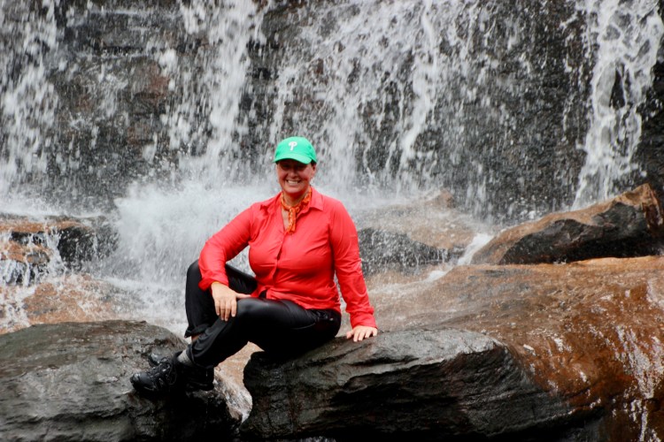
We were there at the right time of the year and the plant was in bloom but the sky was a bit overcast so we didn’t see the vivid 5 color effect but it was still spectacular and an unforgettable experience.


An this is it! How beautiful is that?




Return to San Vincente del Caguan after 3 nights at Playa Alta in La Macarena (October 13-16, 2017)


Silver and Tigger getting a well deserved car wash in San Vicente.


Video of us leaving the small town of San Vicente del Caguan formerly known as the FARC’s Capital!


After the Tatacoa Desert and Caño Cristales adventures with Doug and Fran, we parted ways. They were going to Tierradentro and we were heading towards the small Southern town of San Agustin to see Pre-Columbian statues. Hasta luego amigos!


San Agustin
The small colonial town of San Agustin is located in the department of Huila in the Southern Andes. It’s main attraction is the Archeological Park. It is so charming and laid back with spring like weather it’s a nice place to relax and take in the beauty of it’s landscape for a few days.


San Agustin Archeological park
A Unesco World Heritage Site since 1995, the park contains a museum and over 130 statues with striking human and animal like features, carved tombs and monumental stone tables called dolmens.
Located on three separate sites, totaling 116 hectares, we visited only the main site in San Agustin but the others sites can be visited by horses or jeeps.


Trampoline de la muerte
In order to go to Ipiales where we wanted to cross the border to Ecuador, we had to take this three hour drive up and down this narrow dirt road called Trampoline de la Muerte or Death road. It was built in 1930 to transport soldiers during the war between Colombia and Peru, it spans over 70 km between the towns of Mocoa and San Francisco and zigzags Colombia’s Southern Andes mountain range. Known for frequent land slides due the almost daily rain falls it is however fairly well maintain.
The views were absolutely amazing and the drive was thrilling to say the least, contrary to the other South American famous Death Road in Bolivia, this one is still in use. Therefore the biggest obstacle and danger is the amount of incoming traffic mostly large trucks in a hurry to deliver their loads!


Laguna de la Cocha
A 39,000 hectare volcanic lake in the Pasto municipality, surrounded by cute villages and small hotels and restaurants. The Laguna de la Concha is a popular area with Colombians and Ecuadorians who come to spend the day or the weekend. At 2,680 meters above sea levels the temperature was a bit chilly but still comfortable.


Las Lajas
An engineering masterpiece that looks like a European castle. We had seen many pictures but we were blown away by its beauty and surroundings. The Sanctuary was inspired by miraculous apparition of the Virgin Mary that took place in 1754. A few other shrines were erected where the apparition took place but this one was built between 1916 and 1949.
It was great fun exploring the church, the museum and the country side around it. What a perfect way to end our tour of this fantastic country.


So many travelers told us how much they loved Colombia, after 6 months of exploration, I think we finally know why. It may not possess the most dramatic landscape of South America or the best food or the best infrastructures or be the safest but what makes Colombia such a special place is it’s people. It’s hard to understand why, since they have been through one of the longest civil war in recent history and still they are the friendliest, happiest, most curious, engaging and loving people we have met in our travels! Maybe that’s why, when you have lost so much it is easier to appreciate what you have and cherish the people around you. There is something visceral about the way you feel when you’re in Colombia that you don’t find anywhere else, the constant music, the dancing, the laughter in the streets, just an overall feeling of happiness and content! Goodbye Colombia we hope to see you again one day ♥
Tomorrow, November 1st, 2017 we say goodbye to Colombia and hello to ECUADOR country #12 of this incredible journey!
Border crossing from Ipiales Colombia across the Rumichaca bridge to Tulcan Ecuador.
Few Facts about Colombia:
- Population: 48.65 million (2016) World Bank
- Area: 440,831 sq miles (1.142 million km²)
- Capital: Bogota
- Currency: Colombian Peso (COP) 1 USD = 2,879 COP (2017)
- Time spent: 6 months (May 16 – November 1, 2017)
- Miles driven: 4162
- Diesel price per gallon: $ 2.69 (2017)